Ever walked around a city on a hot summer day and felt the streets and buildings radiate heat back at you? Well, it’s not just your imagination. This phenomenon, known as “urban heat”, has been getting more and more attention lately, and for good reason.
A recent US study has highlighted a worrying trend. According to the National Climate Assessment, almost all regions, except the Northwest, will see a significant increase in heat exposure, both day and night. And this problem is not just confined to the United States. Urban areas of Europe are also in a hot situation, literally. The European Environment Agency reports that nearly half of the schools and hospitals in European cities are located in these urban heat islands. As climate change intensifies, so does the risk to vulnerable populations.
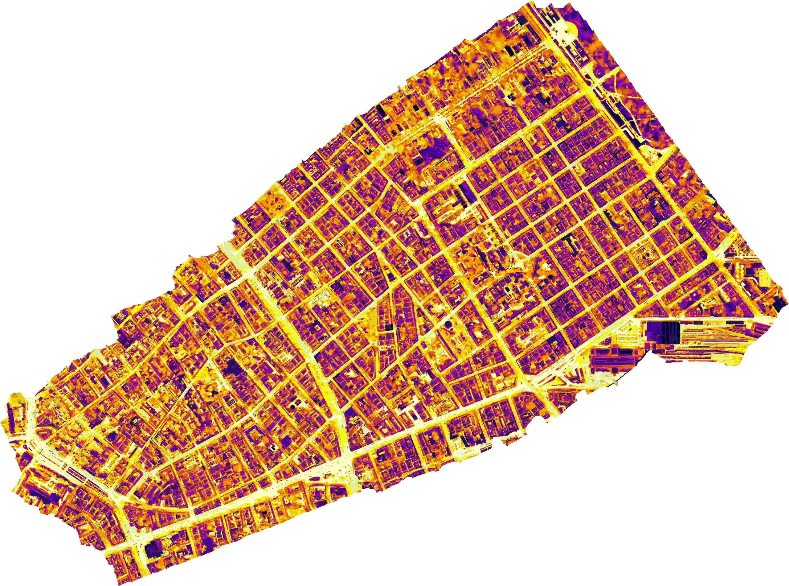
In August 2023, an interesting survey was carried out in Budapest, Hungary. As part of the I-CISK project, the Budapest Living Lab launched a ‘heat mapping campaign’ in Terézváros and Erzsébetváros, two of the city’s central districts. It was no ordinary campaign; drones equipped with thermal imaging cameras flew over the city, recording heat emissions in an unprecedented way.
The timing of the drone flights was key. We took to the skies after sunset to ensure that the heat data collected was as accurate as possible and not affected by the sun’s rays. But the data collection was not just over the city. On the ground, a team of volunteers armed with thermal cameras roamed the streets. They mapped not only the hot spots but also the cooler areas, giving a comprehensive picture of the city’s heat.
Now, all the data – drone footage, ground temperature measurements and high-resolution satellite imagery – is being put to hard work by a convolutional neural network (CNN). The goal? To reveal urban and land use patterns in the areas most affected by heat. This is not just scientific curiosity, but about taking actionable steps to make Budapest safer and more resilient to rising temperatures.
Imagine a future where this data is openly available on an information platform accessible to adaptation initiatives. By analysing this data, we can pinpoint specific areas of intervention within districts where action is needed to reduce heat. It is about turning data into action. It is not just about tackling climate change, but also about actively adapting to it. As this project develops, the knowledge gained will be invaluable in finding innovative solutions to the urban heat challenge.
Our partner: AirScan.hu

